Description
This material is part of the Montessori geography curriculum for the elementary level. In the primary level, children begin with the concrete presentation of constructed land and water forms, depicting in concrete form the concept of land and water. This concept is followed by a relationship between a continent and an ocean; later, the children learn the names of the continents and the oceans. Thus the children progress from the concrete representation of land and water to the abstract line on a map which means an island, lake or some other form of land and water. The passage from a three dimensional representation of the continents and oceans to a two-dimensional representation can be achieved through the use of nomenclature cards. Land & Water Forms Elementary consists of 10 sets of three-part nomenclature cards that contain a description, a label, and a picture card for matching purposes. There are two wallcharts representing all the parts together. The booklet serve as control for error for the nomenclature matching work.
Contents
Interactive Video Lessons
Digital Three-Part Cards
What’s this? (Speech Recognition Activities)
Digital Booklet
Digital Flashcard Quizzes
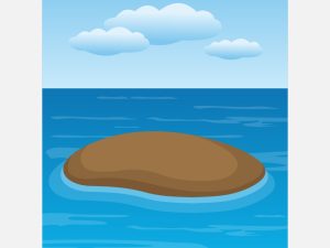
10 land and water forms represented:
island
peninsula
archipelago
cape
isthmus
lake
gulf
bay
strait
chain of lakes
Skills
-aids in identifying common land and water forms
-enriches vocabulary
-enhances classification skills
-promotes concentration
Prior Knowledge Recommended
First Knowledge of the Earth
The Fourth Globe
The Geography Puzzle Maps and Question Cards
Land and Water Forms sensorially (three-dimensional)
Recommended Age
6-9
Subjects
Land and Water Forms